Solon, Ohio
| Solon, Ohio | |
|---|---|
| City | |
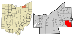
 Location in Cuyahoga County and the state of Ohio. | |
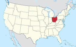
 Location of Ohio in the United States | |
| Country | United States |
| State | Ohio |
| County | Cuyahoga |
| Area | |
| • Total | 20.48 sq mi (53.05 km2) |
| • Land | 20.36 sq mi (52.75 km2) |
| • Water | 0.12 sq mi (0.30 km2) |
| Elevation | 1,040 ft (317 m) |
| Population (2010) | |
| • Total | 23,348 |
| • Estimate (2019) | 22,779 |
| • Density | 1,118.54/sq mi (431.87/km2) |
| Time zone | Eastern (EST) (UTC-5) |
| • Summer (DST) | EDT (UTC-4) |
| ZIP code | 44139 |
| Area code(s) | 440 |
| Website | https://www.solonohio.org/ |
| For infobox source see[1] | |
Contents
Municipality Well Data
| Well ID | Operator Name | Permit Date | Spud Date | Configuration | License Status |
|---|---|---|---|---|---|
| 34-035-20095 | HISTORIC OWNER | 1946-01-01 | 1946-08-01 | Vertical | Plugged and Abandoned |
| 34-035-20249 | HISTORIC OWNER | 1955-03-17 | Vertical | Plugged and Abandoned | |
| 34-035-21849 | BASS ENERGY CO INC | 2005-08-19 | 2005-09-17 | Vertical | Producing |
| 34-035-21882 | PIN OAK ENERGY PARTNERS LLC | 2006-01-19 | 2006-02-25 | Vertical | Producing |
| 34-035-21928 | GONZOIL INC | 2017-02-14 | 2006-12-06 | Vertical | Final Restoration |
| 34-035-21930 | GONZOIL INC | 2013-04-19 | 2006-12-12 | Vertical | Final Restoration |
| 34-035-21968 | SOMMER HOMER E & MAXINE | 2013-09-05 | 2007-04-02 | Vertical | Domestic Well |
| 34-035-21969 | EOS ENERGY LLC | 2007-04-13 | 2007-06-24 | Vertical | Producing |
| 34-035-22014 | PIPES PURSIE E | 2011-07-05 | 2007-12-18 | Vertical | Final Restoration |
| 34-035-22015 | PIPES PURSIE E | 2007-12-11 | 2007-12-18 | Vertical | Not Drilled |
| 34-035-22016 | CUTTER OIL COMPANY | 2013-07-22 | 2008-02-21 | Vertical | Final Restoration |
| 34-035-22032 | EOS ENERGY LLC | 2008-04-16 | 2008-10-13 | Vertical | Producing |
| 34-035-22036 | BAAY OIL LLC | 2018-04-16 | 2008-07-07 | Vertical | Plugged and Abandoned |
| 34-035-60045 | HISTORIC OWNER | Vertical | Not Drilled | ||
| 34-035-61117 | HISTORIC OWNER | Vertical | Not Drilled | ||
| 34-035-61118 | HISTORIC OWNER | Vertical | Not Drilled | ||
| 34-035-61119 | HISTORIC OWNER | 1900-01-01 | Vertical | Plugged and Abandoned | |
| 34-035-61120 | HISTORIC OWNER | Vertical | Not Drilled | ||
| 34-035-61121 | HISTORIC OWNER | Vertical | Not Drilled | ||
| 34-035-61122 | HISTORIC OWNER | Vertical | Not Drilled | ||
| 34-035-61123 | HISTORIC OWNER | Vertical | Not Drilled | ||
| 34-035-61124 | HISTORIC OWNER | Vertical | Not Drilled | ||
| 34-035-61126 | HISTORIC OWNER | Vertical | Not Drilled | ||
| 34-035-61127 | HISTORIC OWNER | Vertical | Not Drilled |
For data sources see[2]
References
- ↑ "Solon, Ohio#". Wikipedia. Retrieved 2021-01-11.
- ↑ "Risk Based Data Management System". Ohio Department of Natural Resources. 2020-11-16. Retrieved 2020-11-16.