Warsaw, Wyoming County, New York
| Warsaw, New York | |
|---|---|
| Town | |
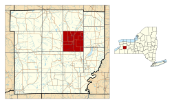
 Location within Wyoming County and New York | |
| Country | United States |
| State | New York |
| County | Wyoming County |
| Founded | 1804 |
| Area | |
| • Total | 35.47 sq mi (91.86 km2) |
| • Land | 35.42 sq mi (91.73 km2) |
| • Water | 0.05 sq mi (0.13 km2) 0.14% |
| Elevation | 1,020 ft (310 m) |
| Population (2010) | |
| • Total | 5,064 |
| • Density | 138.47/sq mi (53.46/km2) |
| Time zone | EST (UTC-5) |
| • Summer (DST) | EDT (UTC-4) |
| ZIP code | 14569 |
| Area code(s) | 585 |
| For infobox source see[1] | |
Contents
Municipality Well Data
| Well ID | Operator Name | Permit Date | Spud Date | Configuration | Well Status |
|---|---|---|---|---|---|
| 31-121-00950 | Bradley Salt Co. | Vertical | Unknown | ||
| 31-121-03303 | Miller Salt Co. | Vertical | Unknown | ||
| 31-121-06073 | Flanigan Brothers | 1968-10-22 | Vertical | Plugged And Abandoned | |
| 31-121-10936 | CNG Transmission Corp. | 1974-07-09 | 1974-07-09 | Vertical | Plugged And Abandoned |
| 31-121-13662 | PPP Future Development Inc. | 1978-09-22 | 1978-12-06 | Vertical | Active |
| 31-121-13892 | Miller Kathleen M. | 1979-02-12 | 1979-02-13 | Vertical | Active |
| 31-121-13915 | PPP Future Development Inc. | 1979-03-26 | 1979-04-08 | Vertical | Inactive |
| 31-121-13919 | Ricotta Deborah | 1979-04-03 | 1979-04-17 | Vertical | Active |
| 31-121-18597 | Bauer James & Scarborough Michael | 1983-10-07 | 1983-10-15 | Vertical | Active |
| 31-121-19937 | U. S. Energy Development Corporation | 1985-03-27 | 1985-03-30 | Vertical | Plugged And Abandoned |
| 31-121-53847 | National Church Residences | Vertical | Plugged And Abandoned |
For data sources see[2]
References
- ↑ "Warsaw, New York". Wikipedia. Retrieved 2021-07-19.
- ↑ "Public Wells Data". New York State Department of Environmental Conservation. 2019-08-09. Retrieved 2019-08-09.