Buffalo County, South Dakota
| Buffalo County, South Dakota | |
|---|---|
|
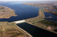
Fort Thompson Big Bend Dam. | |
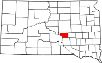
 Location in the state of South Dakota | |
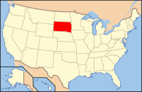
 South Dakota's location in the U.S. | |
| Founded |
1864 (created) 1871 (organized) |
| Named for | American buffalo |
| Seat | Gann Valley |
| Largest community | Fort Thompson |
| Area | |
| • Total | 488 sq mi (1,264 km2) |
| • Land | 471 sq mi (1,220 km2) |
| • Water | 16 sq mi (41 km2), 3.4 |
| Time zone | Central: UTC-6/-5 |
| Footnotes: For infobox source see[1] | |
Contents
County Well Data
| Well ID | Operator Name | Well Type | Well Status |
|---|---|---|---|
| 40-017-05000 | D. W. Crawford and H. L. Case | Never Drilled | Never Drilled |
| 40-017-20001 | Hunt Oil Co. | Never Drilled | Never Drilled |
| 40-017-20002 | Hunt Oil Co. | Dry Hole | Abandoned |
| 40-017-20003 | Hunt Oil Co. | Dry Hole | Abandoned |
For data sources see[2]
References
- ↑ "Buffalo County, South Dakota". Wikipedia. Retrieved 2020-11-04.
- ↑ "Petroleum related wells". U.S. Geological Survey. 2014-08-06. Retrieved 2020-09-12.
