Watson Township, Lycoming County, Pennsylvania
| Watson Township, Lycoming County, Pennsylvania | |
|---|---|
| Township | |
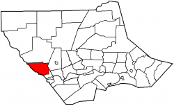
 Map of Lycoming County, Pennsylvania highlighting Watson Township | |
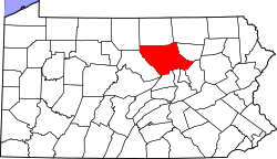
 Map of Lycoming County, Pennsylvania | |
|
Coordinates: 41°14′53″N 77°19′21″W / 41.24806°N 77.32250°WCoordinates: 41°14′53″N 77°19′21″W / 41.24806°N 77.32250°W Fatal error: The format of the coordinate could not be determined. Parsing failed. | |
| Country | United States |
| State | Pennsylvania |
| County | Lycoming |
| Settled | 1784 |
| Incorporated | 1845 |
| Government | |
| • Type | Board of Supervisors |
| • Chairman | James Seltzer |
| • Vice-chairman | James Potter |
| • Supervisor | Charles Knarr, Sr. |
| Area | |
| • Total | 23.5 sq mi (61.0 km2) |
| • Land | 23.2 sq mi (60.1 km2) |
| • Water | 0.4 sq mi (0.9 km2) |
| Elevation[1] | 1,699 ft (518 m) |
| Population (2000) | |
| • Total | 550 |
| • Density | 23.7/sq mi (9.2/km2) |
| Time zone | Eastern (EST) (UTC-5) |
| • Summer (DST) | EDT (UTC-4) |
| FIPS code | 42-81576[2] |
| GNIS feature ID | 1216776[1] |
| Website | Watson Township |
Municipality Details
Oil and Gas Activity
Template:Watson Township, Lycoming, PA-wells
- ↑ 1.0 1.1 "US Board on Geographic Names". United States Geological Survey. 2007-10-25. Retrieved 2008-01-31.
- ↑ "American FactFinder". United States Census Bureau. Retrieved 2008-01-31.