Difference between revisions of "Lower Turkeyfoot Township, Somerset County, Pennsylvania"
m |
|||
| Line 86: | Line 86: | ||
|- | |- | ||
|} | |} | ||
| + | ==References== | ||
| + | {{Reflist}} | ||
| + | |||
__NOEDITSECTION__ | __NOEDITSECTION__ | ||
Revision as of 02:36, 10 May 2014
| Lower Turkeyfoot Township, Somerset County, Pennsylvania | |
|---|---|
| Township | |
 The Lower Humbert Covered Bridge in Lower Turkeyfoot Township | |
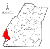
 Map of Somerset County, Pennsylvania Highlighting Lower Turkeyfoot Township | |
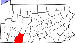
 Map of Somerset County, Pennsylvania | |
| Country | United States |
| State | Pennsylvania |
| County | Somerset |
| Area | |
| • Total | 36.3 sq mi (94 km2) |
| • Land | 36.0 sq mi (93 km2) |
| • Water | 0.3 sq mi (0.8 km2) |
| Population (2000) | |
| • Total | 672 |
| • Density | 18.7/sq mi (7.2/km2) |
| Time zone | Eastern (EST) (UTC-5) |
| • Summer (DST) | EDT (UTC-4) |
Municipality Details
Oil and Gas Activity
| Well ID | Operator Name | First Permit Date | Spud Date | Unconventional | Horizontal | Producing | Violations |
|---|---|---|---|---|---|---|---|
| 111-20297 | CHEVRON APPALACHIA LLC | 2010-06-10 | 2011-04-19 | Y | Y | ACTIVE | None |
References